This page contains automatically translated content.
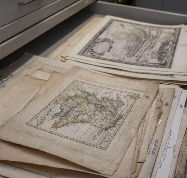
A look at the maps: The map collection of the Kassel University Library and its indexing
Lecture
Old maps and plans provide us with information about the course of historical borders, the historical development of cities and where a particular building stood in the past. Maps offered and still offer orientation and at the same time serve as a store of knowledge, giving us an insight into the perception of spaces and even the world view of their time. The reasons for researching them are correspondingly diverse: they are indispensable documents for regional researchers, map and art historians as well as archaeologists and historical geographers.
The Kassel University Library - Landesbibliothek und Murhardsche Bibliothek der Stadt Kassel (UB Kassel) has a collection of almost 6,000 sheets of maps from the 17th to 21st centuries. This collection has been systematically viewed and recorded for the first time in recent years. The imminent completion of this project now offers the opportunity to provide an insight into the map cabinets and to present the map collection of the Kassel University Library, whose main characteristic is its regional profile. The maps and plans are thus part of our cultural heritage and make an important contribution to the collective memory of the region. This will be illustrated using selected examples of maps, including some from Kassel.